

The R word
Retreat, managed and otherwise

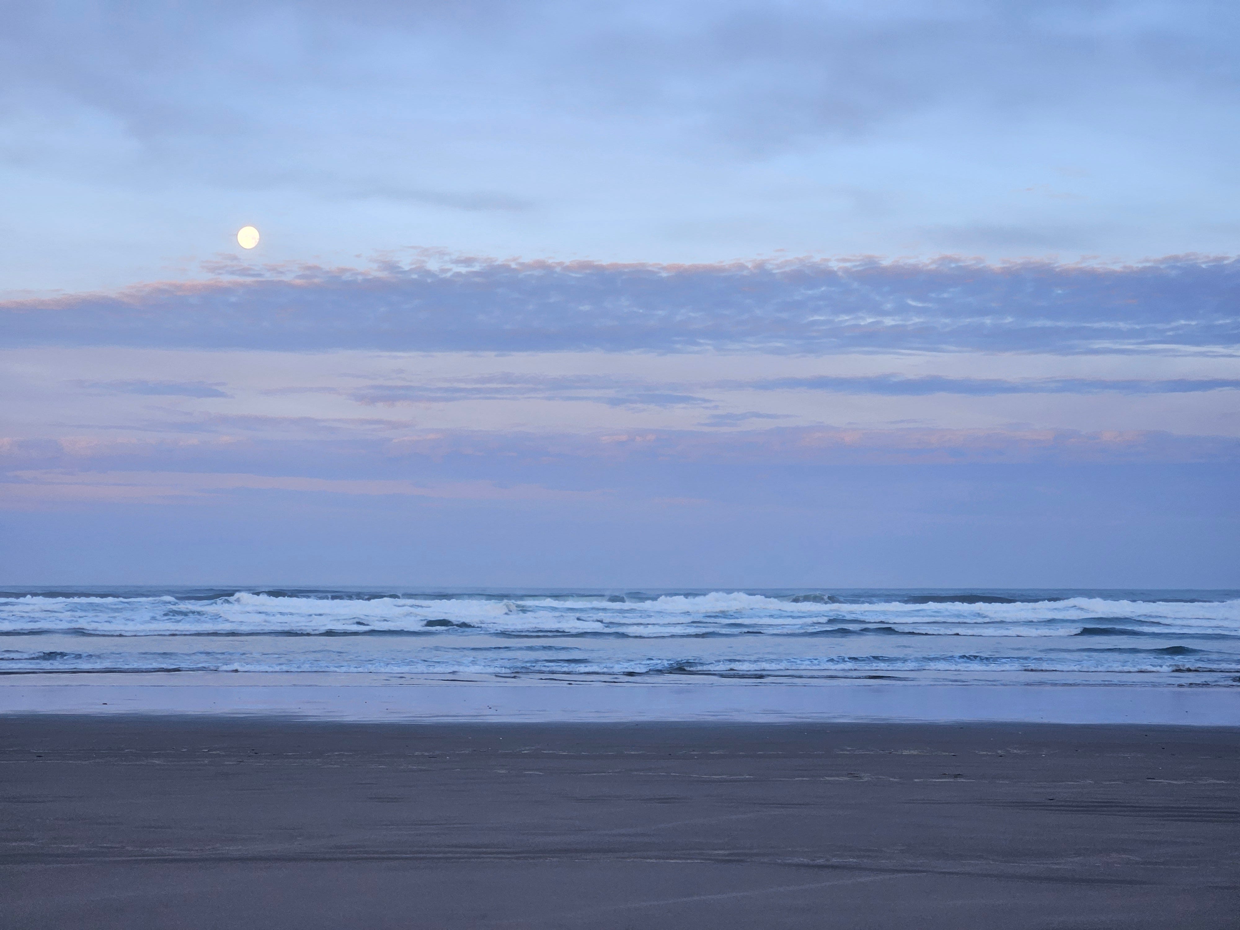
Earlier this month we took a quick trip to the Oregon Coast. I wasn't looking for a water story. One found me anyway.
“Are you ready to head back?” asks my wife.
“Sure.” Our feet are tired after a big hike yesterday, but the unseasonably warm and sunny February day and the wide beach makes another walk too good to pass up. We’re on the ocean side of the Bayocean Peninsula, a sand spit that separates Tillamook Bay from the Pacific Ocean.
“We can cut across the dunes and head back on the road. Better than just walking back on the beach.” A dirt road runs along the bay side of the spit.
“OK, sure. There’s a trail across a little further up.”
“We should be able to cross anywhere we see a path into the dunes. My toe hurts, the one I stubbed.”
“The marked trail's only about a quarter of a mile up.” I’ve pulled up a map on my phone. I like my maps.
“What about right here? Look, there are footprints from that mother and daughter,” my wife insisted.
We’d seen them head up the road from the parking lot and then again just now on the beach. They’ve apparently crossed the dunes without tragedy befalling them.
“OK, I guess that should work.”
We retreated into the dunes on an unmarked and unmapped overgrown trail, soon with head-high tufts of dune grass either side and bushes scratching our legs, relying on the weak winter sun and the map on my phone for navigation, until we come to an intersection. Should we turn right or go straight? I figure straight, which is towards the road. It should get us out quicker. But soon the trail turns sharp left, now heading north, parallel to the beach and the road and away from the parking lot, and keeps on going and going, the bushes taller, the trail narrower. We consider turning back but decide to keep going.
Eventually we reach a sign, but not the one we’d been looking for, which would have said “Parking lot this way,” but “Bayocean Townsite 1906 - 1971.” There’s no trace of a town now, just sand dunes and ghosts.
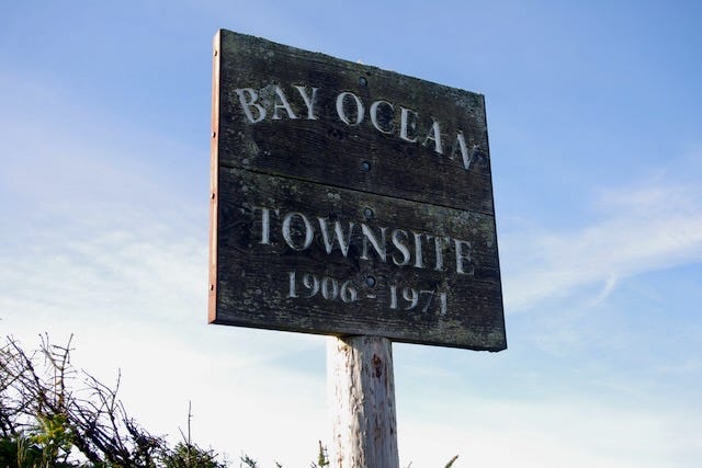
A little way past the sign our path met a wider path, according to my phone the path I wanted to take originally. We turned right and quickly reached the dirt road and found another sign, actually three of them, that told the story of the rise and fall of Bayocean, Oregon.


Thomas Benton Potter and his son Thomas Irving Potter had a dream to develop the Atlantic City of the West on this spit. Construction started in 1906 with the first lots sold in 1907, with 600 of the available 2,000 sold by 1914. The town had a dance hall, a hotel with an orchestra, a heated natatorium, shops, and even a school.
The local Port Commission wanted a deeper entrance to Tillamook Bay for shipping traffic. The Army Corps of Engineers suggested two jetties, one each side of the channel between the tip of the spit and the mainland. Because of cost, only the north, mainland side, jetty was built. The disruption in ocean currents caused erosion of sand on the spit. In 1932 a storm destroyed the natatorium; by 1938, 59 homes had disappeared; in 1939, the first breach appeared; by 1952 it had become a mile wide. In 1971, the last structure was destroyed, and Bayocean was returned to the sand and the waves.
Skirting the puddles on the dirt road, we complete our retreat to the parking lot, where we find a birder peering through his scope. His Prius has an OPB sticker, Oregon Public Broadcasting, who made this Field Guide, with video, to Bayocean: Bayocean: The lost resort town that Oregon forgot - OPB
As we leave, I’m thinking about the shoreline properties in harm’s way from sea level rise and climate change-driven increases in storm intensity on our island and around the world, amplified in some cases by the unintended consequences of coastal engineering projects, and wondering how many will end up like Bayocean, reclaimed by the dunes and the sea.
Further north on the West Coast, the village of Taholah, at the mouth of the Quinault River in the Quinault Indian Nation on Washington State’s Olympic Peninsula, is at a triple risk of inundation from tsunamis, storm surge, and riverine flooding. The community and elected leaders have decided to relocate the village to higher ground about half a mile away.

Many Native communities in Alaska are also undergoing relocation miles inland due to melting sea ice and thawing permafrost leaving their coastlines vulnerable to catastrophic erosion. Native American land ownership structures, where the land itself remains communally owned, and a tradition of community-based decision making makes this kind of move a little easier to accomplish than in other communities.
Nevertheless, one California community, Marina, on Monterey Bay, has made the decision to include managed retreat in its Local Coastal Plan, certified by the California Coastal Commission just this month.
Marina was the subject of this 2020 Los Angeles Times feature by Rosanna Xia: Sea level rise: A small California town embraces managed retreat - Los Angeles Times, expanded to a full chapter in her excellent book, California Against the Sea, Rosanna Xia.

Marina has an advantage in that the dunes adjacent to the shoreline remain undeveloped for now, while the population, one third low income and 60% non-white, strongly supports coastline access for all.
“We have a shot to do it right.… Because of the way we developed, and didn’t develop, we have the ability to have a very good managed retreat process,” [city manager Layne Long] said. “Adopting this plan will ensure for our future generations that our coast is going to remain this way.”
An example of unmanaged retreat is Cama Beach State Park on our neighboring Camano Island. For a number of years, a group open water swimmers and support kayakers made the two-and-a-half mile crossing from Whidbey Island to Camano Island to stay a couple of nights in the historic, and very rustic, cabins.
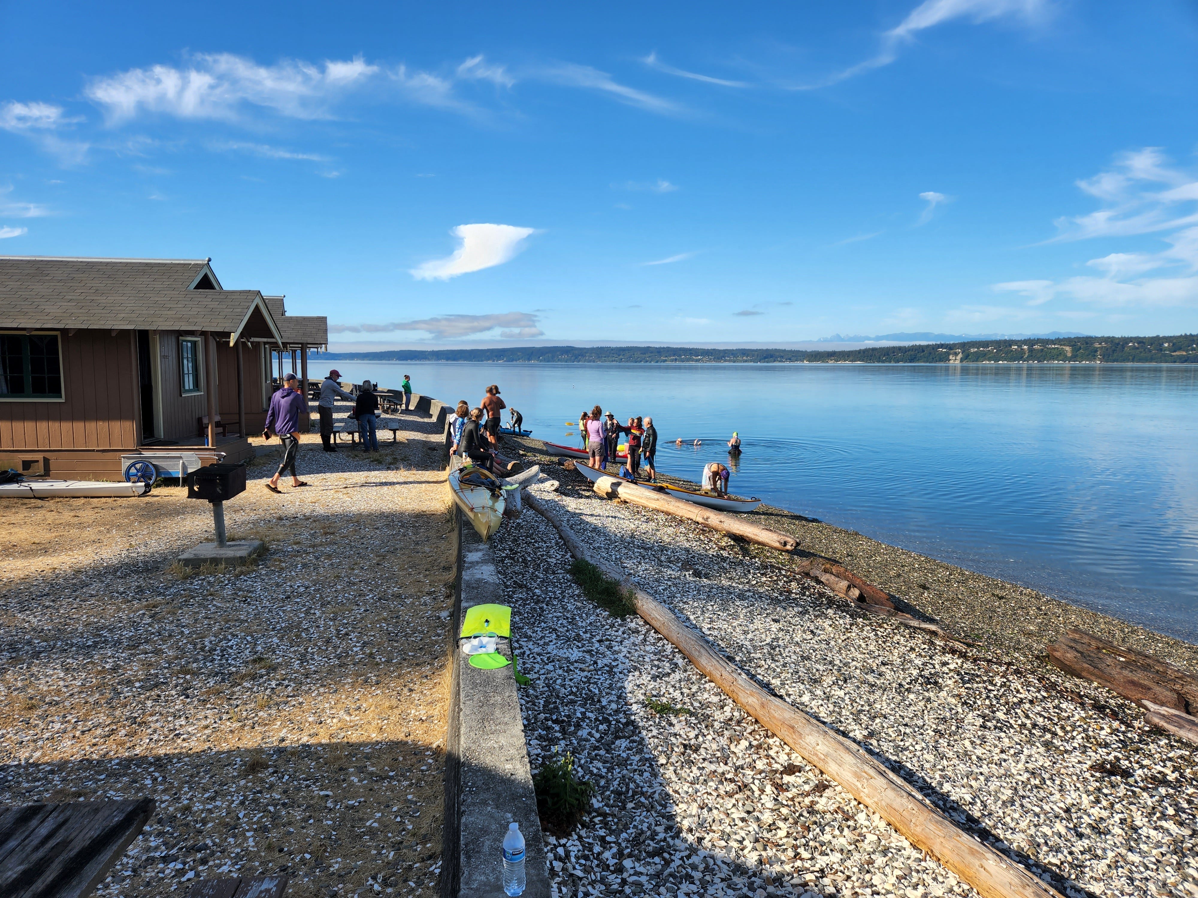
Alas August 2022, pictured above, would be our last visit, as a series of storms, starting in December that year, damaged the cabins and the septic infrastructure, leading to a decision in October 2024 to permanently close the cabins. The most recent storm, in January 2026, collapsed a 20-foot section of seawall, closing the lower section of the park completely, at least temporarily.
Envisaging managed retreat in my home state of Washington is challenging, particularly in Puget Sound. While California and Oregon both have public ownership of coastlines and California has a Coastal Commission, Washington State has neither. Private ownership of shoreline lots and, in some cases, of the adjacent tidelands, makes a coordinated approach to managed retreat from these extremely difficult.

Managed or otherwise, Bayocean’s ghosts won’t be lonely for long.
Thanks, as always, for reading. To make sure you don’t miss a post, please consider becoming a free or paid subscriber.
In Georgia we have the Coastal Marshlands Protection Act that protects our salt marshes, which are held in trust by the State for the public. There’s active efforts happening to erode those protections away so that private docks and development can move in… it’s the “hardening” of a coastline that should be resilient and ebb and flow like the tide. If only more of us lived in awareness of that communion with the land and each other as you referenced!
I've been to Camas Beach Park. While there we were treated to a visit by a humpback whale making his way south not too far offshore.