We're in New Zealand for the Ironman 70.3 World Championships. I wrote about the race last week. In this third dispatch, we moved on to Napier in the Hawke’s Bay district for some post-race R&R. Follow the links to find more on travel and triathlons through the lens of water.
...water issues don't so much follow me as lie in wait to ambush me...
When I wrote that two posts ago, I must have been subconsciously channeling Napier, an Art Deco city with a water story at every turn. The cruise ship passengers, holiday makers, and day trippers, here for the Art Deco buildings and the Hawke's Bay wineries, are blissfully unaware of the city's water risks. The city government, fortunately, with the exception of one key issue, is very much aware. I've relied heavily on the Napier city government website for information and links.
Waterfall
We left Taupō the Monday after race weekend. After coffee, breakfast, and loading the car, we hit the road. Traversing forest plantations and clear-cuts, we headed into the hills. A roadside viewpoint gave us a surprise view of the 40 meter Waipunga falls.
Within two hours we’re in Napier, our base for the next few days. Our AirBnB is in one of the Six Sisters a set of Victorian homes built on Marine Parade in the early 20th Century.
Rain
Hawke's Bay, on the east side of New Zealand's North Island, is normally one of the warmer and dryer locations, but not for the few days we’re there. I have some time look into some of the other water issues.
Waves
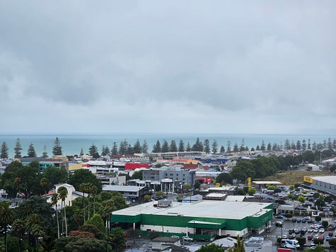
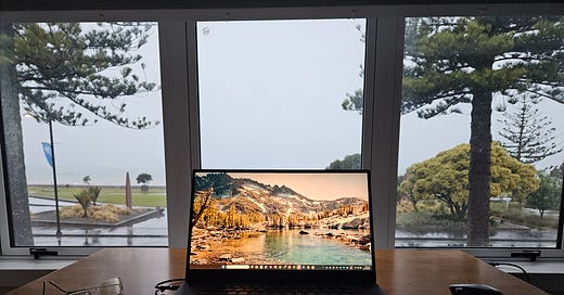
From my writing I look due east past the rain, the iconic Norfolk pines, the roads, the beach, the surf, and the rain-obscured horizon to the Pacific Ocean stretching all the way to Chile!
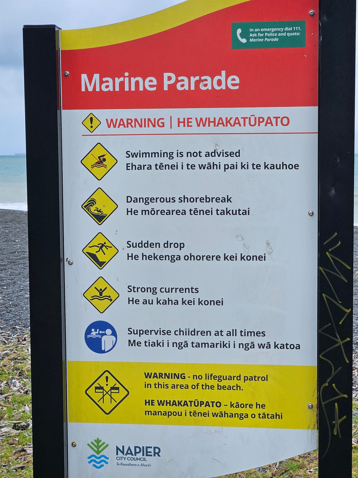
Even when the surf is less high than today, the beach is not safe for swimming.
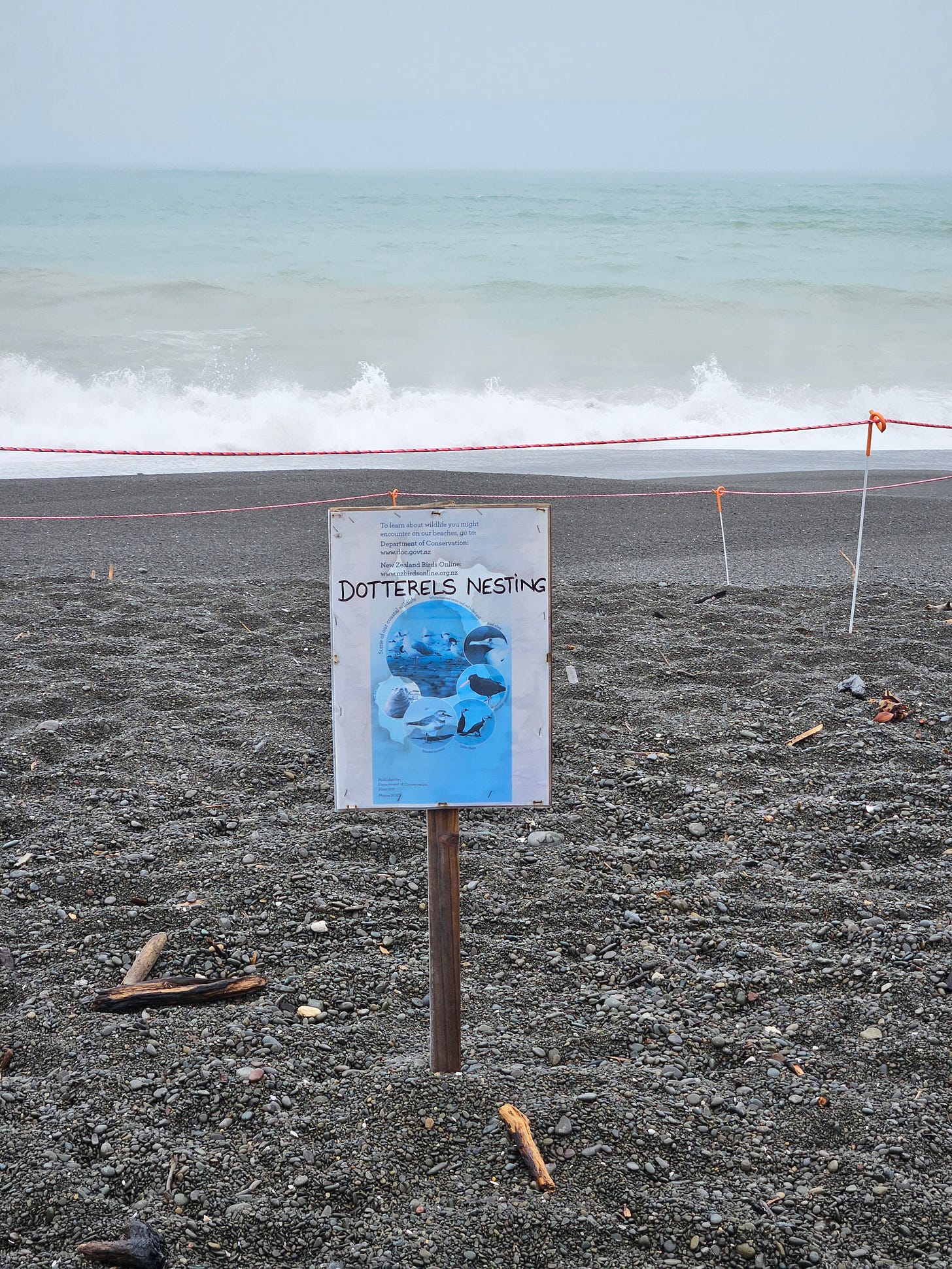
Dotterels, a species of plover, nest among the pebbles on the beach this time of year. The camouflage that protects them from predators unfortunately makes them more vulnerable to accidental predation by human foot traffic, so the nests are fenced off and signed.
Both the Six Sisters, built around 1900 and the Norfolk pines, planted about 20 years earlier, survived both the 1931 earthquake and the 2023 cyclone.
Earthquake
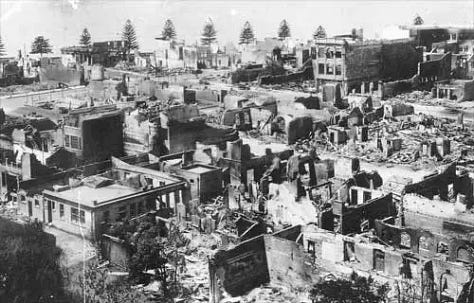
In 1931, the Hawke's Bay region was hit by a powerful earthquake that destroyed much of Napier. MTG (Museum, Theatre, Gallery) Hawke's Bay has an excellent film about the earthquake featuring interviews with survivors.
The earthquake disrupted the water supply, meaning there was no way of stopping fire that destroyed what the earthquake had left of the downtown area. That area was rebuilt in the contemporary architectural style, called modernism at the time and Art Deco today.
The earthquake raised the level of the lagoon adjacent to the city by 1.5 meters and this, together with further drainage, decreased the area of the lagoon and increased the buildable area. Unfortunately, the land is sinking once again at the rate of around 3mm/year, making these areas more susceptible to flooding from cyclones, tsunamis, and sea level rise.
Cyclone
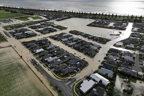
And so, in 2023, Cyclone Gabrielle caused severe flooding from which the city is still recovering.
Tsunami vulnerability
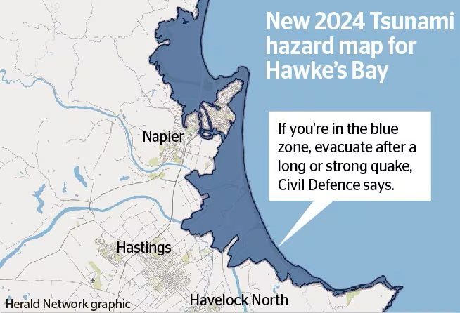
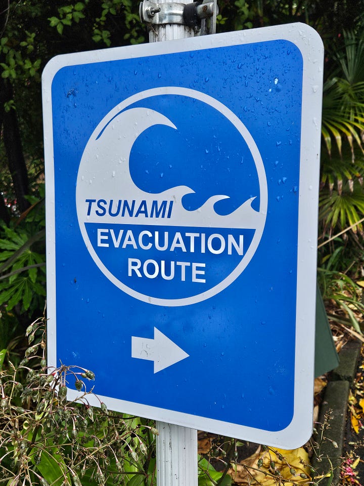
Not surprisingly, given its location in a volcanically active area and its vulnerability to flooding, the city is very vulnerable to tsunamis. Most of the city is in the evacuation zone should an earthquake strike. Fortunately, there's a hill adjacent to the business district and most scenarios would give residents sufficient warning to evacuate. It all makes me feel quite at home, as we have the same sign just down the hill from us back on Whidbey Island!
Sea level rise
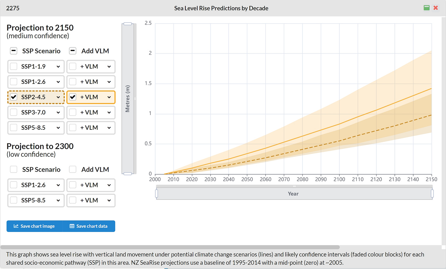
What about sea level rise? Given all we've discovered, it's no surprise that How to solve a problem like Napier, an article from independent news site Newsroom, lists Napier as one of New Zealand's most climate change vulnerable cities. Sea level rise maps and predictive data show around 30 mm of combined sea level rise and land subsidence by 2050, enough to inundate a significant part of the city. Waves and storm surges driven higher by climate change will only accelerate this trend. The article shows how historical land use and development patterns have increased vulnerability and proposes some solutions that may seem radical today but may not when viewed with hindsight.
Level 3 water restriction
All the city government pages I look at have this header:
Napier is now at Level 3 Water Restrictions. Sprinkler ban: Hand-held hoses can be used on alternate days between 6am-8am and 7pm-9pm only. Read more »
Further digging reveals that this is mostly due to demand outstripping supply.
Campylobacter in Havelock North from sheep feces
In August 2016, over 5,000 people were sickened by contaminated drinking water in Napier's neighboring city Havelock North. Local health authorities suspected Campylobacter from sheep feces as the primary infectious agent. The resulting government inquiry brought about major changes in the way drinking water is handled throughout New Zealand.
Dechlorinated water stations
In Napier, for example, the city introduced chlorination to eliminate infections agents such as Campylobacter and E. coli. There's sufficient public resistance to chlorination that the city has set up dechlorinated water stations offering dechlorinated water.
Aquarium
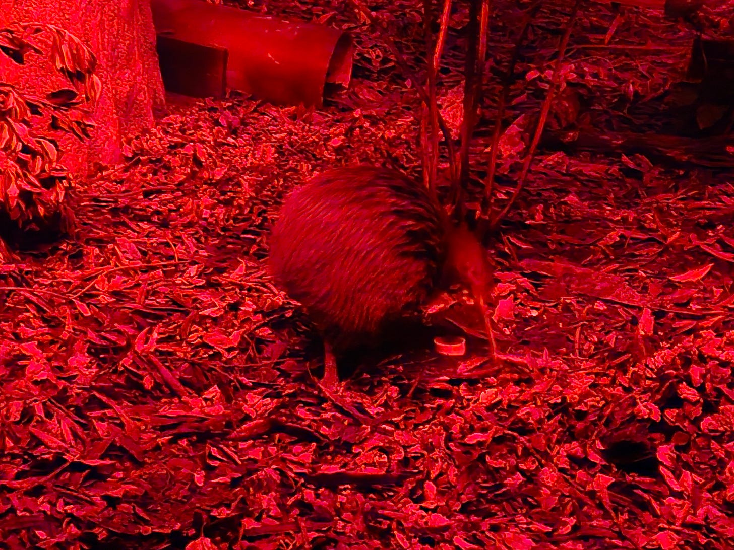
On a final water related note, the city hosts the excellent New Zealand National Aquarium. A pleasant non-water related surprise there is a nocturnal display featuring a Kiwi bird.
Lessons
Although perhaps not obvious at first, there are strong parallels between the Napier area and my home in Puget Sound, Washington. From seismic threats, storms, and sea level rise to contaminated groundwater and drought, we have similar exposures and vulnerabilities. It's always interesting to compare risks, and especially responses. It turns out there are strong parallels, too, in the way local governments are responding. In both places, communication around exposure and vulnerability is good. In both places, however, the glaring exception is sea level rise, where, despite the availability of excellent predictive mapping tools, local governments are silent on sea level rise risk and adaptation.
Thanks, as always, for reading. I'm writing to you today from Okiato, New Zealand, where my writing nook on the verandah looks out over a rainforest to the bay below. In the next post, I'll be writing about our days in Taranaki, followed by a post on our time here in the Bay of Islands.
For triathlon travel next year, we'll be revisiting Oceanside, California and Coeur d'Alene, Idaho, before finishing the season with another visit to Ironman 70.3 Worlds, this time in Marbella, Spain. There's also a trip to Italy in the works. I'll be writing about all of them, along with the water issues that are sure to find me in each place. To make sure you don't miss these posts, please consider becoming a free or paid subscriber.





Fascinating post, John. It’s always fun when traveling to see the parallels as well as the differences between places. Those houses are adorable!